Analyzing Wildlife Habitats: A Map-Based Guide for Hunting & Environment
Wildlife Habitats: Analyzing the Map for Potential Hunting and Environmental Interactions involves a comprehensive understanding of geographical data to responsibly manage hunting activities and preserve ecological balance, focusing on sustainable practices and conservation efforts within specific regions.
Understanding Wildlife Habitats: Analyzing the Map for Potential Hunting and Environmental Interactions is crucial for responsible hunting and environmental stewardship, offering insights into animal behavior, population management, and ecosystem health.
Understanding Wildlife Habitats: A Map-Based Approach
The analysis of wildlife habitats using maps is an indispensable tool for both hunters and environmental conservationists. By understanding the distribution, characteristics, and interconnectedness of these habitats, stakeholders can make informed decisions that promote sustainable hunting practices and environmental preservation.
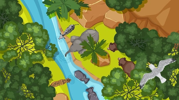
Maps provide a visual representation of complex ecological data, making it easier to identify critical habitats, monitor wildlife populations, and assess the impact of human activities on the environment. This section delves into how maps are used to analyze wildlife habitats, providing insights that can inform hunting regulations and conservation strategies.

The Role of Maps in Habitat Analysis
Maps serve as a foundation for understanding the spatial dynamics of wildlife habitats. They provide a framework for organizing and visualizing data related to vegetation, water sources, topography, and other environmental factors. This information is crucial for identifying suitable habitats for various species and understanding their distribution patterns.
Maps also enable the assessment of habitat connectivity, which is essential for maintaining viable wildlife populations. By identifying corridors that connect fragmented habitats, conservationists can implement strategies to facilitate animal movement and gene flow. Understanding these spatial relationships is vital for effective habitat management and conservation.
- Identifying critical habitats: Maps can highlight areas that are essential for breeding, feeding, and resting, allowing for targeted conservation efforts.
- Monitoring wildlife populations: Maps can track changes in species distribution and abundance over time, providing insights into population trends and habitat use.
- Assessing human impact: Maps can overlay data on human activities, such as logging, agriculture, and urbanization, to assess their impact on wildlife habitats.
In conclusion, maps are an essential tool for understanding the complex relationships between wildlife and their environment. They provide a visual and analytical framework for making informed decisions about hunting regulations and conservation strategies.
Analyzing Potential Hunting Interactions
Hunting can have significant impacts on wildlife populations and ecosystems, both positive and negative. Analyzing potential hunting interactions through map-based data is crucial for promoting responsible and sustainable hunting practices. This analysis involves assessing factors such as game species distribution, habitat quality, hunting pressure, and potential conflicts with other land uses.
By understanding these interactions, wildlife managers can develop hunting regulations that balance the needs of hunters with the conservation of wildlife populations and their habitats. This section explores how maps are used to analyze potential hunting interactions, providing insights that can inform hunting regulations and management strategies.
Assessing Game Species Distribution
Maps showing the distribution of game species are essential for determining hunting quotas and establishing hunting zones. These maps are typically based on data collected through wildlife surveys, telemetry studies, and habitat assessments. By understanding the spatial distribution of game species, wildlife managers can ensure that hunting pressure is appropriately distributed across the landscape.
In addition to species distribution, maps can also illustrate habitat quality, which influences the abundance and health of game populations. High-quality habitats provide abundant food, water, and cover, supporting larger and more resilient populations. By identifying and protecting these critical habitats, wildlife managers can help ensure the long-term sustainability of hunting opportunities.

- Setting appropriate hunting quotas: Maps can help determine the number of animals that can be harvested without negatively impacting population health.
- Establishing hunting zones: Maps can delineate areas where hunting is allowed or restricted, based on species distribution, habitat quality, and safety concerns.
- Monitoring hunting pressure: Maps can track the number of hunters and the amount of harvest in different areas, providing insights into hunting pressure and its effects on wildlife populations.
Analyzing potential hunting interactions through map-based data is crucial for responsible wildlife management. By understanding these interactions, wildlife managers can develop hunting regulations that promote sustainable hunting practices and conserve wildlife populations and their habitats.
Environmental Interactions within Wildlife Habitats
Wildlife habitats are complex ecosystems that are influenced by a variety of environmental factors, including climate, topography, vegetation, and water availability. Understanding these environmental interactions is essential for managing and conserving wildlife populations. Maps can be used to visualize and analyze these interactions, providing insights into the ecological processes that shape wildlife habitats.
This section explores how maps are used to analyze environmental interactions within wildlife habitats, providing insights that can inform conservation strategies and management decisions. By understanding these interactions, stakeholders can develop strategies to mitigate the impacts of climate change, habitat loss, and other environmental stressors on wildlife populations.
Analyzing Climate and Topography
Climate and topography play a crucial role in shaping wildlife habitats. Climate influences temperature, precipitation, and vegetation patterns, which in turn affect the distribution and abundance of wildlife species. Topography influences drainage patterns, soil types, and microclimates, creating a mosaic of habitats that support diverse wildlife communities.
Maps can be used to analyze the relationships between climate, topography, and wildlife habitats. Climate maps can show temperature and precipitation gradients, while topographic maps can illustrate elevation changes and slope aspects. By overlaying these maps with data on vegetation and wildlife distribution, researchers can identify the environmental factors that are most important for different species.
- Predicting climate change impacts: Maps can model the potential impacts of climate change on wildlife habitats, allowing for proactive adaptation strategies.
- Identifying topographic refugia: Maps can identify areas that are buffered from climate change impacts due to their topography, providing potential refuges for sensitive species.
- Managing water resources: Maps can illustrate drainage patterns and water availability, informing water management decisions that support wildlife habitats.
Environmental interactions within wildlife habitats are complex and multifaceted. By using maps to analyze these interactions, stakeholders can gain a better understanding of the ecological processes that shape wildlife habitats and develop strategies to conserve wildlife populations.
Habitat Mapping for Conservation Planning
Conservation planning requires a comprehensive understanding of habitat distribution, quality, and connectivity. Habitat mapping provides a visual representation of these factors, enabling conservationists to prioritize areas for protection and restoration. This section explores how habitat mapping is used for conservation planning, providing insights that can inform the development of effective conservation strategies.
Habitat maps can be created using a variety of data sources, including satellite imagery, aerial photography, field surveys, and ecological models. These maps can depict vegetation types, land use patterns, and other factors that influence habitat suitability for different species. By analyzing these maps, conservationists can identify areas that are most important for biodiversity conservation.
Prioritizing Conservation Areas
Habitat maps can be used to identify areas that are most important for biodiversity conservation. These areas may include critical habitats for endangered species, areas with high species richness, or areas that provide important ecosystem services. By prioritizing these areas for protection, conservationists can maximize the effectiveness of their conservation efforts.
In addition to identifying priority conservation areas, habitat maps can also be used to assess habitat connectivity. Connected habitats allow wildlife to move freely between different areas, maintaining genetic diversity and resilience to environmental change. By identifying and protecting habitat corridors, conservationists can help ensure the long-term viability of wildlife populations.
- Identifying critical habitats: Maps can highlight areas that are essential for the survival of endangered species.
- Assessing habitat connectivity: Maps can show how different habitats are connected, allowing for the protection of habitat corridors.
- Prioritizing restoration efforts: Maps can identify areas that have been degraded or fragmented, allowing for targeted restoration efforts.
Habitat mapping is an essential tool for conservation planning. By providing a visual representation of habitat distribution, quality, and connectivity, habitat maps enable conservationists to prioritize areas for protection and restoration, ultimately promoting biodiversity conservation.
Balancing Hunting and Environmental Needs
Balancing hunting and environmental needs requires a comprehensive and integrated approach that considers the ecological, social, and economic values of wildlife resources. This involves developing hunting regulations that are sustainable and scientifically sound, while also promoting habitat conservation and minimizing conflicts between hunters and other land users.
This section explores how hunting and environmental needs can be balanced through the use of maps and data analysis. By understanding the ecological impacts of hunting and the environmental factors that influence wildlife populations, stakeholders can develop responsible management strategies that benefit both hunters and the environment.
Sustainable Hunting Practices
Sustainable hunting practices are essential for maintaining healthy wildlife populations and ecosystems. These practices involve setting hunting quotas that are based on population data and habitat assessments, as well as implementing regulations that minimize the impact of hunting on non-target species and sensitive habitats.
Maps can be used to identify areas where hunting should be restricted or prohibited, such as near residential areas, critical wildlife habitats, or areas with high conservation value. These maps can also be used to delineate hunting zones and establish hunting seasons that are aligned with the reproductive cycles of game species.
- Setting appropriate quotas: Maps can help determine the number of animals that can be harvested without negatively impacting population health.
- Establishing hunting zones: Maps can delineate areas where hunting is allowed or restricted, based on species distribution, habitat quality, and safety concerns.
- Promoting ethical hunting practices: Maps can educate hunters about responsible hunting behavior and the importance of respecting wildlife and their habitats.
Balancing hunting and environmental needs requires a cooperative effort between hunters, conservationists, and wildlife managers. By working together and using the best available science, stakeholders can develop sustainable hunting practices that benefit both wildlife populations and the environment.
The Future of Wildlife Habitat Mapping
The future of wildlife habitat mapping is likely to be characterized by advancements in technology and data analysis. New remote sensing techniques, such as LiDAR and hyperspectral imagery, are providing increasingly detailed information about habitat structure and composition. These data can be integrated with ecological models to create more accurate and predictive habitat maps.
This section explores the future of wildlife habitat mapping, highlighting emerging technologies and approaches that are likely to transform the field. By embracing these innovations, stakeholders can improve their ability to monitor, manage, and conserve wildlife habitats in a rapidly changing world.
Emerging Technologies
Emerging technologies are revolutionizing the field of wildlife habitat mapping. Drones equipped with high-resolution cameras and sensors are providing unprecedented views of wildlife habitats, allowing for detailed assessments of vegetation, water resources, and animal distribution. Artificial intelligence (AI) and machine learning (ML) algorithms are being used to analyze these data, automating the process of habitat mapping and identifying patterns that would be difficult to detect manually.
Citizen science initiatives are also playing an increasingly important role in wildlife habitat mapping. By engaging volunteers in data collection and analysis, these initiatives can expand the geographic scope of habitat mapping efforts and increase public awareness of conservation issues. The combination of these emerging technologies and citizen science initiatives is paving the way for a more comprehensive and collaborative approach to wildlife habitat mapping.
- Improved remote sensing: New sensors and platforms are providing increasingly detailed information about habitat structure and composition.
- Artificial intelligence: AI and ML algorithms are automating the process of habitat mapping and identifying patterns in ecological data.
- Citizen science: Volunteers are contributing to data collection and analysis, expanding the geographic scope of habitat mapping efforts.
The future of wildlife habitat mapping holds great promise for improving our ability to monitor, manage, and conserve wildlife populations and their habitats. By embracing emerging technologies and fostering collaboration, stakeholders can ensure that wildlife habitats are protected for future generations.
| Key Point | Brief Description |
|---|---|
| 🗺️ Mapping Habitats | Maps visualize wildlife distribution and crucial environmental factors. |
| 🏹 Hunting Analysis | Understanding species distribution for setting quotas and zones. |
| 🌱 Environmental Factors | Analyzing climate and terrain impacts on habitat quality. |
| ⚖️ Sustainable Balance | Integrating science-based hunting with habitat conservation. |
Frequently Asked Questions
▼
Wildlife habitat mapping is the process of visually representing the spatial distribution and characteristics of areas that provide essential resources for wildlife, such as food, water, shelter, and breeding sites. It involves using various data sources to create detailed maps.
▼
Analyzing maps is crucial for hunters to understand game species distribution, access hunting zones safely, and adhere to regulations. It promotes responsible hunting by ensuring hunters are aware of habitat boundaries and protected areas.
▼
Environmental interactions, such as climate, topography, and vegetation, significantly influence the quality and availability of wildlife habitats. Changes in these interactions can alter habitat suitability and impact wildlife populations, emphasizing the need for ecological understanding.
▼
Sustainable hunting practices involve setting quotas based on population data, implementing regulations to minimize impacts on non-target species, and promoting ethical hunting behavior. These practices help maintain healthy wildlife populations and ecosystem balance.
▼
Emerging technologies, such as drones, AI, and citizen science initiatives, are revolutionizing habitat mapping by providing more detailed data, automating analysis processes, and expanding the scope of mapping efforts, ultimately improving our ability to conserve wildlife habitats.
Conclusion
Analyzing wildlife habitats through mapping offers crucial insights for balancing hunting and environmental conservation. Sustainable practices emerge from understanding species distribution, environmental interactions, and utilizing emerging technologies, ensuring both responsible hunting and long-term habitat preservation.


